Shenandoah National Park is located in the Blue Ridge Mountains (part of the Appalachian Mountains) in the state of Virginia. The park is long and narrow, built for motorists to enjoy the 105-mile skyline drive that traverses the park from north to south. With over 75 scenic overlooks, there is plenty for you and your dog to see from the roadways.
But like most national parks, the best experiences can be found along Shenandoah’s 500+ miles of hiking trails. And happily dogs are allowed on over 480 miles of these hiking trails. So what are you waiting for? Read this article to find out everything you need to know about visiting Shenandoah National Park with dogs and then start planning your visit.
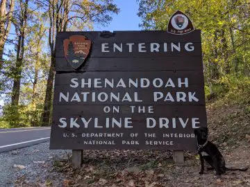
About Shenandoah National Park
Just 75 miles from the bustle of Washington, D.C., Shenandoah National Park is your escape to recreation and re-creation. Cascading waterfalls, spectacular vistas, quiet wooded hollows—take a hike, meander along Skyline Drive, or picnic with the family. 200,000 acres of protected lands are haven to deer, songbirds, the night sky…and you. Plan a Shenandoah escape today!
https://www.nps.gov/shen/index.htm

History
If you count national parks in the order that they were authorized, Shenandoah National Park was the 18th national park – becoming part of the National Park System in 1926. However, this park was not officially opened for another 10 years.
A Virginia congressman, Henry D. Flood, first introduced legislation to create a national park in the Appalachian mountains in 1901. Despite President Theodore Roosevelt support, the legislation failed to pass. Until 1919 (when Acadia National Park was created under President Woodrow Wilson’s administration), all national parks were located in the remote and rugged western half of the United States.
Finally, in May of 1925, Congress and President Calvin Coolidge authorized the National Park Service to acquire land to form Shenandoah National Park. But the state of Virginia still had to raise the funds to acquire the land. After significant effort, Shenandoah National Park was finally established on December 26th, 1935. The park was officially opened on July 3rd 1936.
Blue Ridge Mountains
There are two major national parks within the Blue Ridge province – Shenandoah and Great Smoky Mountains National Park. The Blue Ridge also contains eight national forests.
What is so special about this region of the Appalachian Mountains that it deserves so many national parks and forests?
The Blue Ridge Mountains contain the highest peaks in eastern North America (although technically there are higher peaks on Baffin Island far to the North). There are about 125 peaks that exceed 5,000 feet in elevation. However, most of these peaks are in the southern portion of the Blue Ridge.
In Shenandoah National Park, the highest peak is Hawksbill at 4,049 feet. There are over 60 peaks with an elevation over 3,000 feet inside the park. The lowest elevation can be found on the north end of the park, where the elevation is only 561 feet.

Dog-Friendly Activities in Shenandoah National Park
There is much to do in Shenandoah National Park with your dog, especially if you love hiking like we do. Of the 500+ miles of trails in Shenandoah National Park, around 480 miles are dog-friendly. Standard rules do apply. All pets must be on a leash no longer than 6 feet in length. And they are not allowed on ranger programs.
The park clearly indicates the trails that dogs are not allowed on. There are only 10 of them. Here are the trails that dogs are NOT allowed on, listed from North to South:
- Fox Hollow Trail
- Stony Man Trail
- Limberlost Trail
- Post Office Junction to Old Rag Shelter
- Old Rag Ridge Trail
- Old Rag Saddle Trail
- Dark Hollow Falls Trail
- Story of the Forest Trail
- Bearfence Mountain Trail
- Frazier Discovery Trail
Some of these are popular trails, but we still had a very fulfilling visit to Shenandoah without stepping a foot (or paw) onto these 10 trails. Keep reading to see what we thought of the trails we did hike during our 4-day visit to Shenandoah National Park.
If you want to find out more about pet regulations at Shenandoah National Park, visit the official website. Their webpage discusses some hazards to be aware of, such as possible bear sightings and rocky trails that can be hard on paws.
Overall Run Falls Hike – 3/5
We drove into Shenandoah National Park from the north end and spent our first night at the Matthews Arm Campground (more about the campgrounds later).
As a result, we accessed our first hike in Shenandoah from the Matthews Arm parking lot. We took the Traces Trail to the Tuscarora-Overall Run Trail to the Overall Run Falls overlook and then hiked the Matthews Arm Trail to Matthews Arm Road. A map of these trails can be accessed at the nps.gov site.
We choose this hike as it offers views of the park’s tallest waterfall – Overall Run Falls, which is 93 feet in height. However, this waterfall does not run year-round and was rather dry during our hike. So while the Overall Run Falls Hike was nice, there was nothing spectacular about the portion of this trail that we hiked. The best part about it was the proximity to our campground.
Traces Trail Portion of the Hike
Traces Trail is an easy circuit around Matthews Arm Campground. Shenandoah National Park considers this trail to be generally suitable for anyone who enjoys walking. It is mostly level, with only a 333-foot elevation gain, and the loop is 1. 7 miles round trip.
We only hiked a short portion of this trail. It was an average forested trail, not much different than the trails we are used to hiking back in Minnesota. But if you are looking for an easy hike right from the campground, this is a good option.
Overall Run Falls
If you want to hike the entire Overall Run Falls loop, you will hike 5.1 miles over a 1,291 foot elevation gain. We just hiked out to the viewpoint of Overall Run Falls (which is only about a tenth of a mile from the intersection of Matthews Arm Trail and Tuscarora-Overall Run Trail. There is a section where you can see the upper falls. And if you hike 1,3000 feet further downhill, you will find views of the tallest falls in Shenandoah.
We enjoyed this hike, especially the overlooks into the mountains. But unfortunately, in early fall there was minimal water flow at Overall Run Falls. As a result, the falls themselves were not that impressive.
Honestly the best part of this hike was the view into the valley from the overlook at the upper falls.


Millers Head Trail – 3/5
We drove from Matthews Arm Campground to Big Meadows Campground. On our way, we stopped in the Skyland Area to hike Millers Head Trail. Click here to open the official Skyland Area trail map in a new window.
Millers Head Trail is supposed to be another easy trail (although rocky and a bit steep in portions) at 1.6 miles round trip with a 450-foot elevation gain. The trail starts near the amphitheater and heads to the site of a former fire tower for spectacular views.
The trail is an out and back trail, so theoretically it is 0.8 miles out to the overlook. We didn’t keep track of our mileage, but this hike felt much longer than 0.8 miles out. In fact, we almost turned around just before the overlook as the trail started to make a steep descent and we became concerned we were not on the right trail as we figured that the overlook wasn’t downhill.
Luckily, we persisted and the trail cut back uphill and out to the fire tower site. The views from this site were nice, but I wouldn’t quite call them spectacular. Much of the view was of the valley and town below and just outside of Shenandoah National Park. We had enjoyed similar views from the lookouts along Skyline Drive earlier in the day.
The trail was still worth the short hike, especially if you enjoy the overlooks with civilization below.

The Rose River Loop – 5/5
One of our favorite hikes of the trip was the Rose River Loop Hike just outside of Big Meadows Campground. This is a 4-mile round trip hike with 910 feet of elevation change.
Although you can hike the Appalachian Trail from the campground to Fisher’s Gap Overlook to find the trailhead, we weren’t sure we would return from our hike before our campground checkout time. So we parked in the parking area at the North End of Fishers Gap Overlook. From there we were able to take the Rose River Loop Trail down to Rose River Falls.
The first section of this trail is pretty average. Pretty forest scenery and a nicely maintained trail lead you downhill from the parking lot.

Once you reach the Rose River, the magic begins. First, you hike downhill with the river, passing several small cascading falls and still river pools before reaching the 67 foot tall Rose River Falls (which we didn’t get a great picture of).
Then you begin trekking back uphill past numerous falls and cascades. There are so many places to stop and pull out a camera. It is scenery like this that inspires many of us to take a photography course. The cell phone camera just doesn’t do justice to the peace and beauty of this riverside trail.


As you climb back up to the Rose River Fire Road, you cross a bridge and see the trail to Dark Hollow Falls. This is a popular park attraction, but unfortunately, pets are not allowed on this trail. So we instead took the fire road back to our parked car.
Overall, we highly recommend the Rose River Loop Hike. Find the trail map here (opens in a new window).
Doyles River Falls and Jones Run Falls Hike – 5/5
We spent two nights at Loft Mountain Campground, which meant we had a full day to hike in this area. So we linked a few trails together to enjoy a full day of hiking.
We left the Loft Mountain Campground via the Appalachian Trail and followed the trail to its intersection with Doyles River Trail. We hiked down this trail alongside Doyles River. Doyles River Trail turns into Jones Run Trail as you head back uphill to Jones Run parking lot. We then met back up with the Appalachian Trail and followed it back to our campground. Find the Loft Area Trail Map here (opens in new window) to see the route we hiked.
Since each trail was different, we will discuss them separately below, but overall, this loop was on par with the Rose River Loop and gets a 5/5 in overall rating.
This trail was the busiest we encountered during our trip, but we did complete this loop on a weekend day.
Doyles River Trail
This was our favorite portion of the trail, as both upper and lower Doyles Falls were stunning. The Upper Falls is reported as 28 feet tall, while the lower is 63 feet tall. The trail itself is listed as 3.3 miles round trip – out and back -so it is roughly 1.6 miles one way). The trail descends 1,189 feet as it follows the river, so be ready to power back uphill after viewing the falls.
Both falls provided us with excellent photo opportunities. And while we hiked past at least 4-5 other hiker groups between the upper and lower falls, we somehow had the lower falls to ourselves once we arrived. We were able to climb right down to the base of the lower falls and enjoy a snack with an amazing view.
See some of our photos of the trail below.

Starting the hike on Doyles River Trail 
A small cascade/unnamed waterfall on Doyles River 
Sasha posing along Doyles River 
Upper Doyles River Falls 
Lower Doyles River Falls 
Glia at Lower Doyles River Falls
Due to the narrow trail and higher hiker traffic, use caution if hiking with a reactive dog. Both of our pups did okay, as they are small enough to pick up if needed to get past other dogs, and we came prepared with plenty of good distracting treats. But we always like to give other reactive dog owners a heads up when some of our favorite trails involve narrow, busy hiking trails.
Jones Run Falls
Jones Run Trail is also about 1.6 miles one direction and if hiking uphill like we did, gains 1,045 feet in elevation.
Like Doyles River Trail, this trail was enjoyable with great river views and lovely forested trails. However, Jones Run Falls was not quite as spectacular as either the upper or lower Doyle River Falls. So if you had to pick one or the other, choose Doyles River Trail.

Sasha hiking along Jones Run Trail 
Glia near Jones Run Falls (hard to see, but the falls are behind her on the left side of the picture)
Appalachian Trail
Hiking on a portion of the Appalachian Trail was a bit of a bucket list item for me. While just walking a few miles along this famous trail is nowhere near as epic as thru-hiking the entire trail, it still felt like we were taking part in some small part of history.
For those of you not familiar with this trail, the Appalachian Trail is a 2,180+ mile long public footpath/hiking trail that runs from Georgia to Maine. According to statistics listed in an article published on Be Outdoors Appalachian Mountain Club over 4,000 hikers attempted a thru-hike in 2017. But not all of them completed the trail. In 2016 only 685 people completed the trail. In 2015, 677 hikers made it, while in 2014 690 hikers completed the thru-hike.
While most thru-hikers are humans, some dogs have also completed the Appalachian Trail (minus a few small sections that don’t allow dogs).
In 2019, we followed two different dogs on Instagram who attempted the trail. Arrow hiked with her human, Nav, and successfully completed the Appalachian Trail. Below is a picture of Arrow on the trail and a link to their Instagram account.
We also followed Rue and her human, Grizel. Rue hiked half of the Appalachian Trail before Grizel had to make the tough decision to finish the Appalachian Trail without Rue. This is a great example of knowing your dog’s limits and putting their best interests first. Not all dogs will stay healthy and energetic on a 2,180+ mile hike. Nonetheless, we are impressed that Rue has hiked over 1,000 miles of the Appalachian Trail.
Glia and Sasha have only hiked about 3 miles of the Appalachian Trail, but it was still fun to feel like part of something bigger.
The section of the trail that we hiked offers a fantastic overlook at the Doyles River Overlook in addition to a few great views on the trail as it wraps around the Loft Mountain Campground.
(Note the Doyles River Overlook is near a parking lot, so can also be accessed from your vehicle if you aren’t in the mood for a hike.)

Appalachian Trail marker 
The view from the Appalachian Trail at Doyles Overlook. 
View from the Appalachian Trail around Loft Mountain campground. 
Hiking the Appalachian Trail around Loft Mountain campground.
Camping at Shenandoah National Park
There are four regular campgrounds in Shenandoah National Park, plus one group campground. Campgrounds in Shenandoah are seasonal, typically beginning to open in late March and closing in late fall.
Matthews Arm Campground is the northernmost campground, located at approximately mile 22 of Skyline Drive. It is next to the trail to Overall Run Falls (see above) which is the tallest waterfall in the park. Camping at Matthews Arm cost $15/night as of 2019.
Big Meadows Campground is next, located at mile 51 of Skyline Drive. Big Meadows Campground is near many of the major facilities and popular hiking trails in the park. It is typically the first campground to open in the spring. There are three waterfalls here within walking distance. We hiked to Rose River Falls (see above) and it was one of our favorite trails in the park. The cost to camp at Big Meadows campground was $20/night in 2019.
Lewis Mountain Campground is located off mile 57 of Skyline Drive. It is the smallest campground in the park and is first-come, first-served only. We did not camp here, as we made reservations for our campsites ahead of time. This campground costs $15/night as of 2019.
Finally, Loft Mountain Campground is located along mile 79 of Skyline Drive. This is the largest campground in the park. The campground sits atop Big Flat Mountain, and the Appalachian Trail offers fantastic views to the east and west as it passes around this campground. Two waterfalls, Doyles River and Jones Run (see above), can be accessed from Loft Mountain Campground. These waterfalls are definitely worth the hike. The cost to camp at Loft Mountain was $15/night in 2019.
Dundo Group Campground has three sites available for groups of 7 to 20 people. It is located just north of Loft Mountain Campground.
We enjoyed all three of the campgrounds we stayed at (Matthews Arm, Big Meadows, and Loft Mountain). Some of our campsites were better than others but more important to us was the quality of the hiking trails. And for that, we recommend Big Meadows and Loft Mountain.

Backcountry Camping
Shenandoah also allows backcountry camping throughout the park. Permits are required to camp in the backcountry. They are free and can be obtained at visitor centers and entrance stations (during business hours). Find more information about permits on Shenandoah’s backcountry camping page.
In Shenandoah National Park, backcountry campsites are not posted, signed or designated by the park. So basically you can camp anywhere as long as it fits the following requirements:
- 10 yards away from a stream or other natural water source
- 20 yards from any park trail or fire road
- 50 yards from another camping party or no camping post sign
- 50 yards from any standing buildings or ruins
- 100 yards from a hut, cabin, or day-use shelter
- 1/4 mile away from a paved road, park boundary, or park facility
There are also a few areas closed to camping that you should review before planning your trip. All of these areas are listed on the park’s website.
Please follow basic leave no trace backpacking guidelines/regulations. Shenandoah lists the following rules:
Food, trash, personal hygiene products, and other scented items must be properly stored to prevent bears and other wildlife from accessing them. Human waste must be properly disposed of and all trash must be carried out.
Also, be aware that backcountry campfires are not permitted.
The maximum group size for backcountry camping is 10 individuals, dogs must stay leashed at all times, and backcountry camping may not exceed 2 nights in one location.
Lodging
Not interested in camping? Big Meadows Lodge (mile 51 on Skyline Drive) has a limited number of pet-friendly rooms available. Head over to GoShenandoah.com (opens in new window) for more information.
Not what you are looking for? Another option for lodging in Shenandoah National Park is Skyland. Skyland (located at mile 41 on Skyline Drive) also has a limited number of pet-friendly rooms available. Their information can also be found at GoShenandoah.com (this link will open in a new window and takes you to Skyland Lodging information).
And finally, Lewis Mountain Cabins (located at mile 57) are rustic, furnished cabins with private baths and outdoor grill areas. There is one designated pet-friendly cabin available. More information about this cabin can also be found at GoShenandoah.com (also opens in a new window).
For those looking for more primitive lodging, consider the cabins maintained by the Potomac Appalachian Trail Club. These cabins are equipped with mattresses, blankets, and cookware. There is a pit toilet and spring water nearby. There are a few of these cabins that do not allow pets, but from what I could see, all of the cabins within Shenandoah National Park allow dogs. Just note that pets are not allowed on bedding (including blankets and mattresses) in consideration of fellow renters with allergies.
Information about these cabins can be found at PATC.net. And there is even a cabin along Doyles River Trail (one of our favorite hikes listed above).
Dog-Friendly Activities in the Surrounding Areas
Honestly, this national park blog post doesn’t even need this section. Shenandoah National Park offers plenty to do with your dog inside the park boundaries.
Check out Shenandoah National Park’s list of nearby attractions for some inspiration outside of this national park.
But if you are looking for other national park adventures, check out our post on the nearby Cuyahoga Valley National Park.
Overall Experience at Shenandoah National Park
As mentioned above, we spent 4 days in Shenandoah National Park and we could have spent longer. There are so many dog-friendly trails here. We loved the trails around the Big Meadows and Loft Mountain campgrounds in particular, but we also drove by so many trailheads that we didn’t have a chance to explore.
While many of the waterfalls in Shenandoah were small, the cascading rivers made up for the smaller size with an intimate and secluded riverside hiking experience. *Note: none of Shenandoah’s waterfalls are visible from Skyline Drive, so plan on hiking if you want to enjoy the falls.
There were also several lovely overlooks. We loved how many overlooks could be accessed right from the road. This helps more people enjoy the park.
Our only complaint about the overlooks is that because Shenandoah National Park is long and narrow, many of the views included towns and roads. After visiting so many western national parks, most of which are remote and far from neighborhoods, the urban overlooks lacked a bit in that awe-inspiring wonder of seeing only nature for miles. That being said, when the fog was present in the mornings, you could forget how close you were to the valley towns and imagine a wilder place.
Overall, what Shenandoah lacks in wild, remote, impressive views, it makes up for in dog-friendly hikes along cascading rivers. The park overall gets a 4/5 from us and we wouldn’t hesitate to stop and hike in Shenandoah National Park again.

